|
Climate:
| Total annual precipitation (mm) |
451 |
| Annual snowfall (cm) |
180 |
| Water deficit (mm) |
--- |
| Mean July temperature (C) |
+15.8 |
| Mean January temperature (C) |
-23.1 |
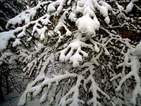
The climate is humid and cold. The winters are long and cold,
and the summers, short. The change in season occurs gradually.
| |
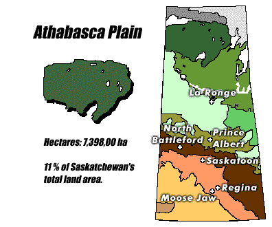
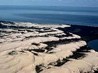
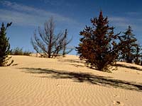
Landscape:
The area is a rolling
drift plain with prominent eskers (a snake shaped steep ridge
of roughly layered sand and gravel) and sand dunes. The Athabasca
Sand Dunes, south of Lake Athabasca, is an extensive area of active
dunes.
|
Soil:
Sandy soil originates from sandstone bedrock.
|
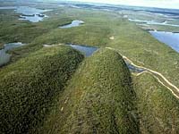
Vegetation:
Coniferous, or evergreen, forests dominate the region. The forest
is dominated by medium to tall stands of jack pine with
understories of feathermoss, bog cranberry, blueberry, Labrador
tea and lichen. Some white spruce, balsam poplar
and trembling aspen occur in the warmer moister sites in
the southwestern sections of the forest. Bedrock exposures have
few trees and are covered with lichens.
|
Wildlife:
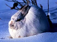
This is important winter range for caribou. There are moose,
black bear, lynx, wolf, beaver, muskrat and snowshoe
hare (shown left) as well. Waterfowl, sandhill cranes, grouse occur with
other birds.
|
Human Use:
The discovery of uranium ore at various locations has led
to road development and the impacts of mining operations.
Forest resources are generally used locally, however forests are
harvested for pulp wood in the southern section of the region.
Trapping, hunting and fishing are the traditional land
uses on the sand plain south of Lake Athabasca.
|
|