

![]()
|
|
"Environmentally Sensitive Area". Please be careful where you walk and try not to disturb the natural environment. For additional information please contact Tourism Saskatchewan. | ||
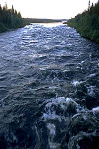
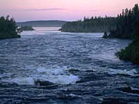
Otter Rapids | |||
| GPS: | 55d 38.76m N | 104d 44.08m W | 1362 feet |
| Location: | 80 kms north of La Ronge. | ||
| |||
| GPS: 55d 38.76m N, 104d 44.08m W, 1362 feet 14 August 96, 10:30 am, Fuji Velvia 50, F22 1/15s | |||
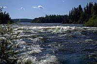
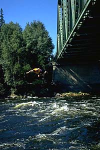
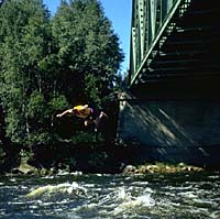
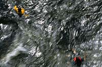
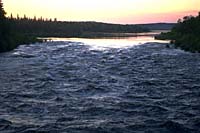
Otter Rapids is one of the best known and most easily accessed sets of rapids on the Churchill River system. | |||
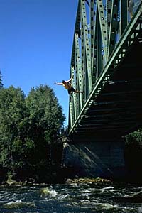
Those of you without canoes or kayaks can put on a lifejacket and swim through the rapids where even the paddlers can't go. | |||
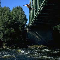
Some brave (foolish?) individuals even jump into the turbulent waters from the bridge. | |||
| |||
| |||
| |||
| |||
| |||
| |||
| |||
| |||